Australia’s Flood Maps Are a Mess and No One Can Agree Who Should Fix Them
So, what exactly is flood mapping?
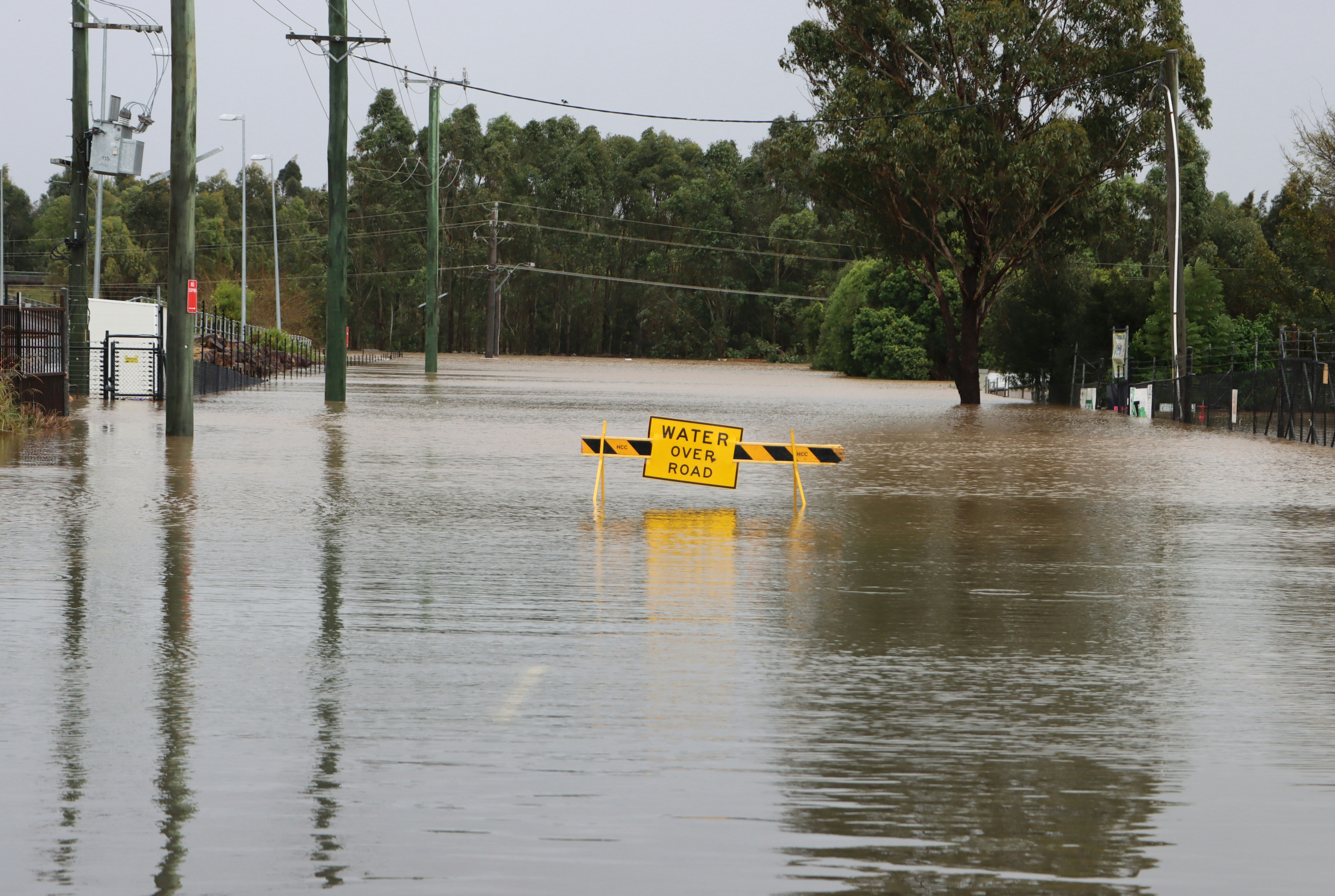
Across the country, flood maps are the invisible lines that decide what can (and can’t) be built. But how those lines are drawn depends on who’s holding the pen
In Queensland, more than 70 local governments maintain their own flood models. Some update them yearly with new rainfall and topography data; others haven’t refreshed theirs since the 8’s. That means one property might be deemed high-risk in Logan, yet considered perfectly buildable just across the border in Ipswich.
It’s no wonder frustration is rising.
That’s why residents leading the petition for statewide flood mapping, say Queensland needs a unified standard, a single source that balances safety with development certainty. But others argue that local councils understand their geography best, and that state control could flatten out the nuance needed to plan effectively at a local level.
Supporting this, let's look at the debate unfolding in South Brisbane. The state government is proposing to transform the old Visy glass factory on Montague Road into a mixed-use precinct with thousands of new homes, despite the site sitting squarely on a known floodplain. Locals have watched the river break its banks there before, and many are questioning why large-scale development is even being considered.
Urban planning expert Laurel Johnson told the ABC, “Flood risk management should be fundamental to any urban redevelopment… this is not a new issue for Brisbane.” Yet, somehow, it still feels like the lessons from past floods aren’t being applied where they matter most.
A different story in Victoria…
If Queensland’s issue is devolution, Victoria’s might be centralisation.
Earlier this month, Melbourne Water released new flood maps predicting which areas could be under in a once-in-a-century storm. For thousands of residents across the Yarra and Darebin catchments, the news came out of nowhere. One day, their properties were compliant, the next, they weren’t.
Yarra Council called the move a “blindside,” arguing that the state was shifting the burden onto local residents without consultation. Homeowners suddenly found themselves within newly classified flood zones, their property values and redevelopment options potentially affected overnight.
So whether it’s too many maps (in Queensland) or too much control in one place (in Victoria), the result is the same: uncertainty, frustration, and a planning process that feels more reactive rather than resilient.
So, what do we do?
Local Knowledge vs. State Consistency
At the heart of this debate is a simple question with no simple answer.
Local councils argue they understand their areas best, the creeks that flood every few years, the roads that turn into rivers, and the drains that overflow first.
State governments argue for a unified framework. One methodology, one map, one rulebook to keep things consistent.
But in reality, both have a point. Local nuance matters. So does consistency. The problem is that Australia’s current system forces us to choose between the two.
The Real Issue: Data Without Connection
Here’s the truth: Australia isn’t short on flood data. We’re drowning in it (pardon the pun).
Every council, department, and consultant has their own models, assumptions, and files. But few of those systems actually talk to each other, and therein lies the problem.
So while flood mapping should be about public safety and better planning, it’s too often about human interpretation and guesswork.
That’s the gap where technology can easily step in.
A Smarter Way Forward
At Planna, we see this issue firsthand. The confusion that stems from mismatched maps, shifting rules, and disconnected communication between councils and state government.
Flood overlays. Zoning layers. Council guidelines. State policies. Every rule that’s meant to clarify something ends up scattered across portals and PDFs.
Our goal is simple: make planning easy to understand and act on.
Planna’s software integrates data from more than 20 planning sources, from local flood maps to state overlays, and keeps it constantly updated. Whether the information comes from a council’s local study or a government-wide model, Planna merges it into one clear, accurate picture.
This means:
- Development professionals can make confident decisions, knowing they’re working with the latest, verified information.
- Projects move faster without having to hunt through dozens of PDFs and reconciling conflicting maps
- Everyone, from councils to residents, has clarity
With constant updates and expansion across NSW, Victoria, and soon Queensland, Planna ensures that no matter where you are, the planning landscape is clear, navigable, and reliable.
The planning landscape is complex — but it doesn’t have to be.
Discover how Planna simplifies it and book a demo today.
Read more


